Seddülbahir
İkiz Koyu (X Sahili)
Seddülbahir'e çıkarma yapan işgal kuvvetlerinin bir başka çıkarma noktası da İkiz Koyu'dur. İşgal kuvvetleri bu koya "X Beach" ("X Sahili") adını vermiştir. (İkiz Koyu adının, Türkçe okunuşları fonetik olarak çok yakın olan X harfinden geldiği sanılmaktadır.)
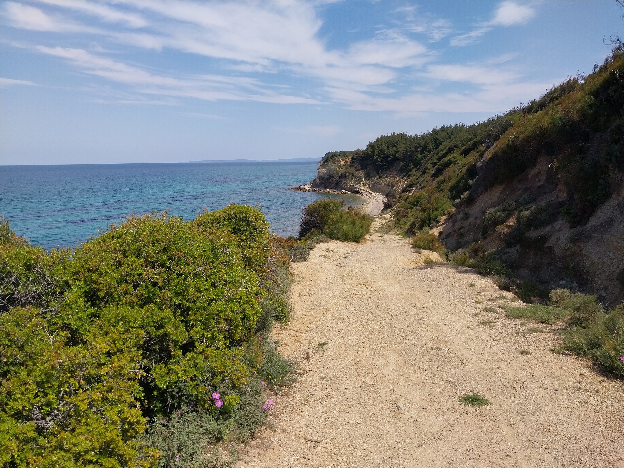
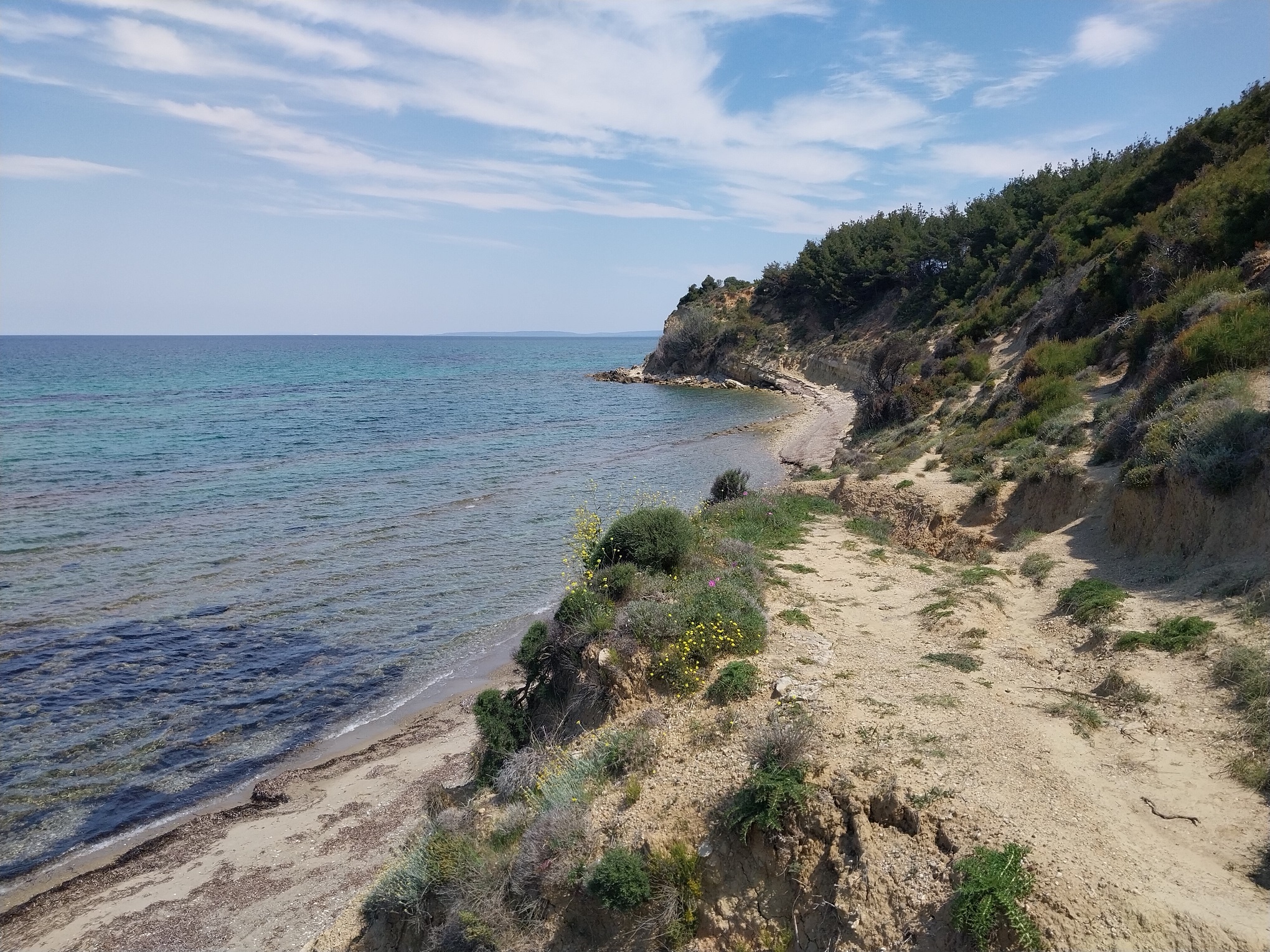
Ertuğrul ve Tekke koylarına göre daha kısa bir plajı bulunan İkiz Koyu, söz geçen diğer iki koyun aksine çok dik ve yüksek bir yamaca sahiptir.
Cape Helles
Ikiz Cove (X Beach)
Another landing point for the invasion forces at Cape Helles was Ikiz Cove. The invasion forces named this cove "X Beach." (It is believed that the name "Ikiz Cove" is derived from the letter X, as its Turkish pronunciation is phonetically very similar.)
Ikiz Cove, with a shorter beach compared to Ertuğrul and Tekke Coves, has a much steeper and higher hillside, in contrast to the other two cove locations.
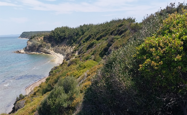
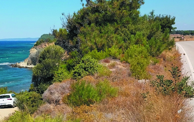
İlk sıradaki fotoğraflardan tarihi olan 1915 yılında çekilmiştir. Fotoğraf, İkiz Koyu'na inen, bugün de az çok aynı durumda olan yokuşu ve sahili göstermektedir. Bugün yaklaşık olarak aynı konumda durularak çekilen fotoğrafta, söz konusu bölgede büyüyen maki ve çalılar nedeniyle sahile inen yokuş görünmemektedir. (Bu yokuşu gösteren bir fotoğraf sayfanın en altına ayrıca eklenmiştir.)
The historical photograph in the first set was taken in 1915. It shows the beach and the slope leading down to Ikiz Cove, which remains largely the same to this day. In the contemporary photograph, taken from approximately the same location, the slope leading to the beach is not visible due to the growth of maquis and shrubs in the area. (The photo showing this slope has also been added at the very bottom of the page.)
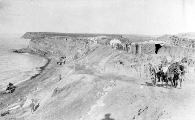
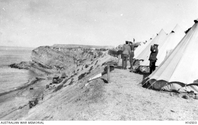
Koyun 1915 yılında, yaklaşık olarak güneybatıdan kuzeydoğu yönüne doğru çekilmiş bir fotoğrafı.
A photograph of the cove, taken in 1915, looking approximately from southwest to northeast.
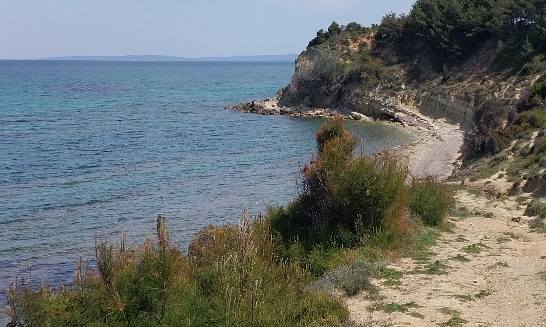
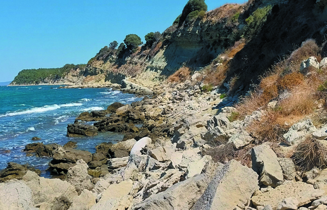
Üçüncü sıradaki fotoğraf plajın üst kısmını da gösteriyor. Güncel fotoğrafta görünen asfalt yolun istikameti Tekke Koyu'nden Zığındere yönünedir.
The third photograph also shows the upper part of the beach. In the current photograph, the direction of the visible asphalt road runs from Tekke Cove toward Gully Ravine.
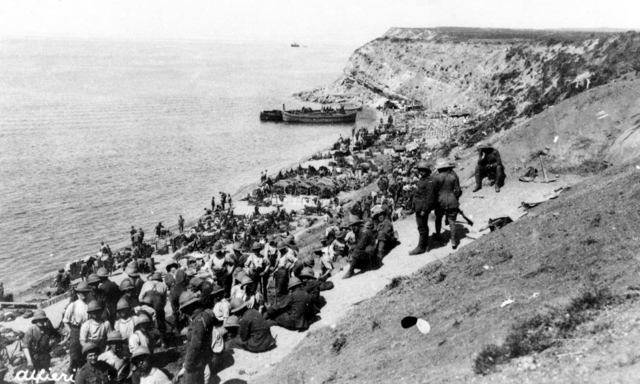
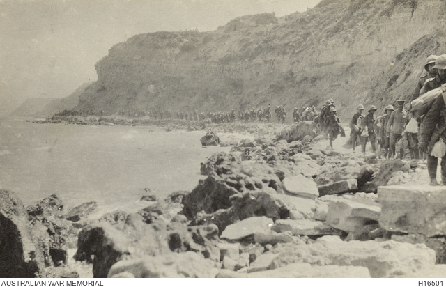
Tarihi fotoğraf, Zığındere'den X Koyuna hareket eden birlikleri göstermektedir. Fotoğrafın alındığı kaynağa (url-1) göre, işgal kuvvetlerinin tahliyesi esnasında çekildiğine inanılmaktadır.
The historical photograph shows troops moving from Gully Ravine towards X Cove. According to the source from which the photo was obtained (url-1), it is believed to have been taken during the evacuation of the invading forces.
İkiz koyuna inen yokuşun başından ve ortasından çekilmiş iki fotoğraf. Günümüzde koya inmek için hala bu yol kullanılmaktadır. Ancak yol, yağmur suyu akıntıları nedeniyle birkaç noktadan kesilmiş durumdadır. (Bu yarıklardan biri ikinci fotoğrafta görünmektedir.)
Two photos taken from the beginning and the middle of the slope leading down to the Ikiz Cove. This path is still used to reach the cove today. However, the road is cut at several points due to rainwater runoff. (One of these cuts can be seen in the second photo.)
Kaynaklar
url-1: https://www.awm.gov.au/collection/C381485. Erişim Tarihi: 11.10.2025