Seddülbahir
Seddülbahir Kalesi
Seddülbahir Kalesi, 1659 yılında Osmanlı Devleti tarafından inşaa edilmiş bir kaledir. Mimarı Mimar Mustafa Ağa'dır. Kalenin yaklaşık olarak orta noktasının koordinatları 40°02'31"N 26°11'17"E'dir.
Kale 1914 ve 1915 yıllarında İtilaf Devletleri tarafından bombardımana tutulmuştur. 1914 yılındaki bombardımanda kalenin cephaneliği patlamış, kale komutanı dahil olmak üzere 5 subay ve 81 asker hayatını kaybetmiştir. 1915 bombardımanlarında ise kale büyük yıkıma uğramıştır.
Kale sonradan restore edilmiş olmakla beraber, tarihi fotoğraflarda yer alan bazı yapılar bugün kısmen ya da tamamen kaybolmuş durumdadır.
Cape Helles
Sedd-el-Bahr Fortress
Sedd-el-Bahr Fortress is a fort constructed by the Ottoman Empire in 1659. Its architect was Mustafa Agha. The approximate central coordinates of the fortress are 40°02'31"N 26°11'17"E.
The fortress was subjected to bombardment by the Allied Powers in 1914 and 1915. During the 1914 bombardment, the ammunition depot of the fortress exploded, killing the fortress commander together with 4 other officers and 81 soldiers. In the bombardments of 1915, the fortress suffered major destruction.
Although the fortress was later restored, some of the structures visible in historical photographs are now partially or entirely lost.
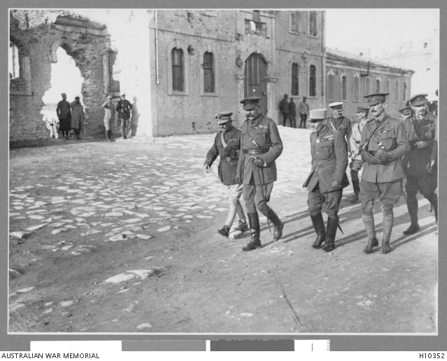
İlk fotoğraflarda, Savaş Bakanı Lord Kitchener'ın Seddülbahir Kalesi'ni ziyareti görülmektedir. Fotoğrafta, heyetin önünde bulunduğu kışla binası günümüzde bulunmamaktadır. Ancak binanın temeli halen görülebilmektedir.
Kitchener'ın ziyaretinden kısa bir süre sonra İtilaf Devletleri kuvvetlerinin Gelibolu Yarımadası'ndan tahliyesi kararlaştırılmıştır.
The first photograph shows War Minister Lord Kitchener’s visit to Seddülbahir Fortress. The barracks building in front of which Kitchener and his delegation are walking no longer exists today. However, the foundation of the building is still visible.
Shortly after Kitchener’s visit, the decision was taken to evacuate the Allied forces from the Gallipoli Peninsula.
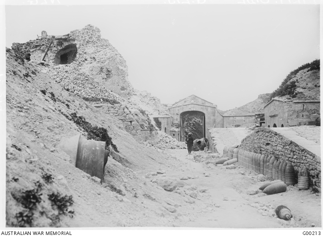
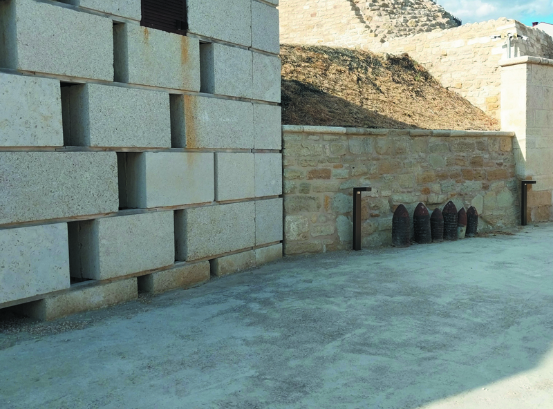
Kalenin kuzey doğu yönündeki kapısını içten gösteren bir fotoğraf.
Fotoğrafın sağ tarafında görünen rampaların yüksek kısımlarından kale toplarının mevzilerine, alçak kısımlarından ise bonetlere ulaşılmaktadır.
A photograph showing the northeastern gate of the fortress from the inside.
From the higher sections of the ramps visible on the right side of the photograph, access is provided to the fortress gun emplacements, while the lower sections lead to the bonnets.
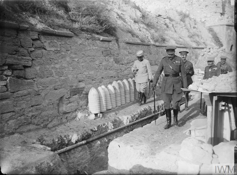
Savaş Bakanı Lord Kitchener, bu kez yukarıdaki fotoğraflarda yer alan kale kapısının hemen yanında.(url-1)
This time, War Minister Lord Kitchener is standing right next to the fortress gate shown in the photographs above. (url-1)
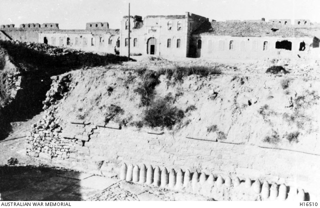
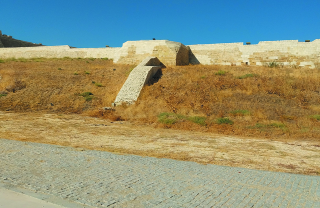
Günümüze ulaşamamış bir başka yapı. Burası, kalenin güneybatısında yer almakta ve denize doğru bakmaktadır.
Another structure that has not survived to the present day. It is located on the southwest side of the fortress, facing the sea.
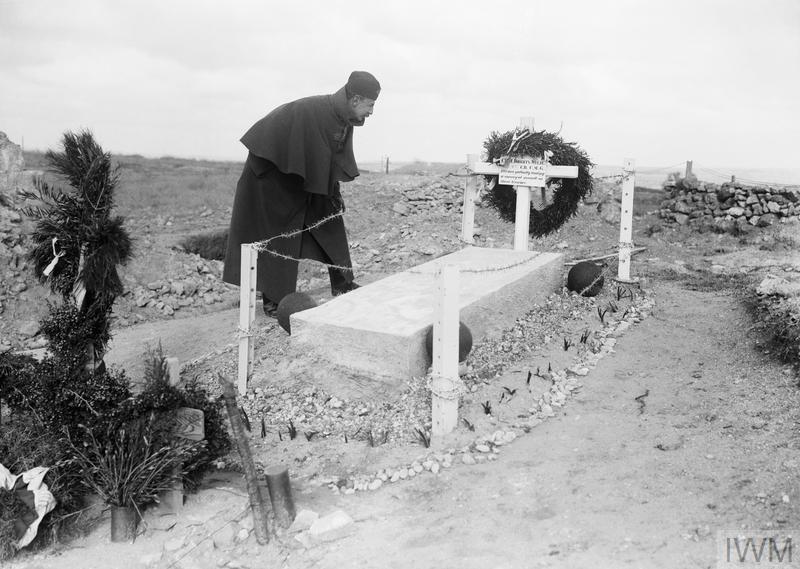
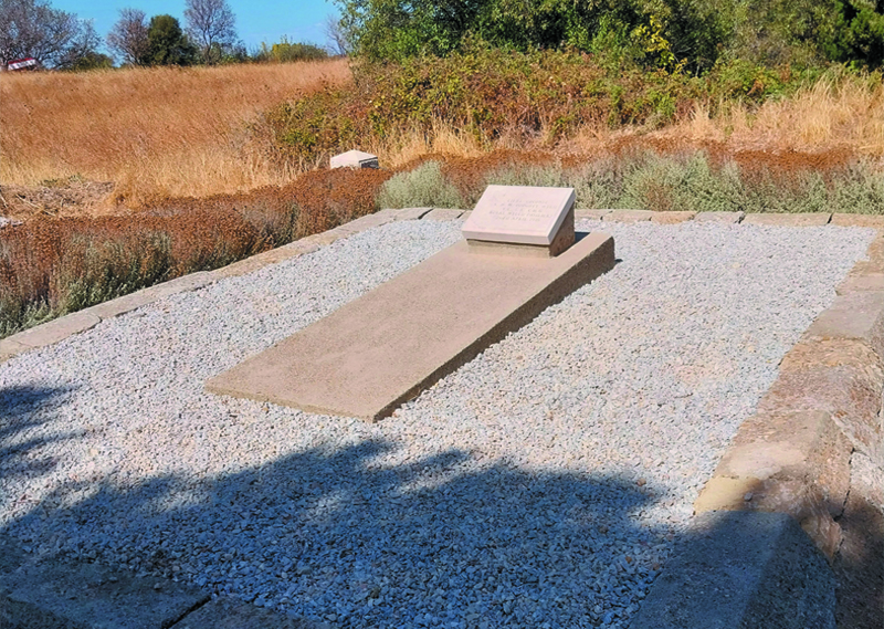
Yarbay Charles Doughty-Wylie'nin mezarı. (url-2)
İngiliz yarbayı Doughty-Wylie, 26 Nisan 2015 tarihinde Seddülbahir'e düzenlenen saldırıyı planlamış ve yönetmiş, saldırı başarıya ulaştığı esnada vurularak hayatını kaybetmiştir. (url-3)
Ertuğrul Koyu'na (V Sahili) River Clyde isimli gemiyle gelen Yarbay Doughty-Wylie, Birinci Dünya Savaşı öncesinde Konya ve Mersin'de konsolos yardımcısı olarak görev yapmış ve Adana'da da bulunmuştur. Çanakkale Muharebeleri'nden iki sene önce, 1913 yılında, Osmanlı Devleti tarafından ikinci sınıf Mecidiye Nişanı ile ödüllendirilmiş olması ironiktir. Mezar yeri, Seddülbahir Kalesi'nin giriş kapısından kuş uçuşu 430 metre kadar kuzeyde, Harapkale Tepesi'ndedir. Koordinatları 40°02'47"N 26°11'22"E'dir.The grave of Lieutenant Colonel Charles Doughty-Wylie. (url-2)
British Lieutenant Colonel Doughty-Wylie planned and led the attack on Seddülbahir on April 26, 1915, and was shot and killed as the assault achieved success. (url-3)
Lieutenant Colonel Doughty-Wylie, who reached Ertuğrul Bay (V Beach) aboard the ship named River Clyde, had previously served as vice-consul in Konya and Mersin before the First World War and had also been stationed in Adana.
It is ironic that, two years before the Gallipoli Campaign, in 1913, he was awarded the Second Class Order of the Medjidie by the Ottoman Empire.
The grave is located on Harapkale Hill, about 430 meters north of the entrance gate of Seddülbahir Fortress. Its coordinates are 40°02'47"N 26°11'22"E.
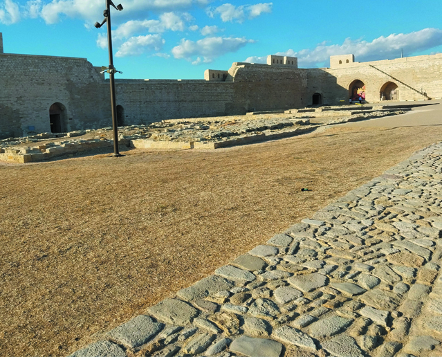
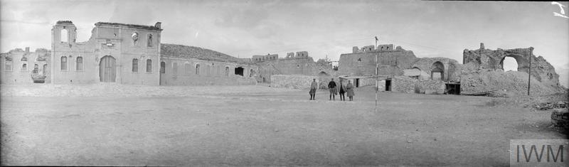
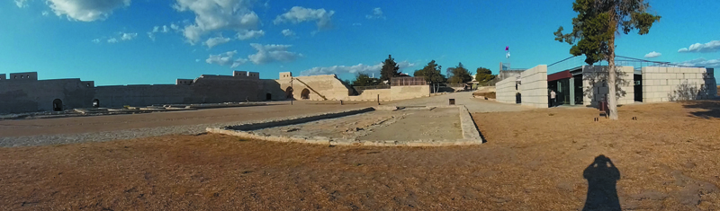
Seddülbahir Kalesi'nin içten bir panaromik görünümü. Günümüz fotoğrafının sol ilerisinde, tarihi fotoğraftaki kışla binasının temeli görünüyor. Günümüz fotoğrafının en sağında, bugün müze ve kafe olarak kullanılan yapılar bulunuyor. Bu yapıların hemen solunda görülen açıklık, günümüze ulaşmayan Bab-ı Kebir adlı ana kapının bulunduğu yerdir. Günümüzde de alana giriş buradan sağlanmaktadır.
A panoramic view inside Sedd-el-Bahr Fortress. In the present-day photograph, slightly to the left, the foundation of the barracks building from the historical photograph can be seen. On the far right are the buildings now housing a museum and café. Just to their left lies the spot where the main gate, Bab-ı Kebir, once stood—a gate that has not survived to the present day. Visitors still enter the fortress through this historic entrance.
Kaynaklar
url-1: https://www.iwm.org.uk/collections/item/object/205248768 © Image: IWM (Q 13591) Erişim Tarihi: 21.09.2025
url-2: https://www.iwm.org.uk/collections/item/object/205223153 © Image: IWM (Q 13709) Erişim Tarihi: 21.09.2025
url-3: https://www.thegazette.co.uk/London/issue/29202/supplement/6115 Erişim Tarihi: 21.09.2025
url-4: https://www.iwm.org.uk/collections/item/object/205278766 © Image: IWM (Q 44411) Erişim Tarihi: 21.09.2025